 Agent Access

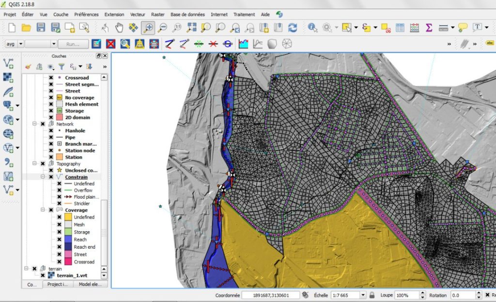
The first comprehensive tool to model the water cycle, integrated within an open source GIS environment.
Please check the dedicated Setec Hydratec’s website: www.hydra-software.net
![]()
The first comprehensive tool to model the water cycle, integrated within an open source GIS environment.
Please check the dedicated Setec Hydratec’s website: www.hydra-software.net
![]()
[:fr]
Vous disposez d’un droit d’accès, de rectification, ou d’effacement des données nominatives vous concernant, et le cas échéant, d’un droit à la portabilité de vos données. Vous pouvez demander la limitation du traitement, vous opposer au traitement de vos données, ou le cas échéant retirer votre consentement. Vous pouvez également définir des directives sur le sort de vos données après votre mort. Pour exercer ces droits, adressez un e-mail à : setec@setec.fr. Vous disposez du droit d’introduire une réclamation auprès d’une autorité de contrôle.
[:en]You have the right to access, rectify or erase personal data concerning your information and if need be, the right to the portability of your data. You can at any time limit the treatment, oppose the processing of your data and if necessary to withdraw your consent. You can leave specific instructions on the fate of your data in the case of death. To exercise these rights, please send an e-mail to setec@setec.fr. You have the right to lodge a complaint with a supervisory authority.[:]


